The last two days I have had the opportunity to see Mt St. Helen up close. On Thursday Chuck and I went to the South side. The first photos are of the two forests. Rapid flowing Volcanic Lava flowed around the trees and developed the holes once the tress burned out. Tree logs that laid down also created tunnels
A Lava vent created the Ape Cave.
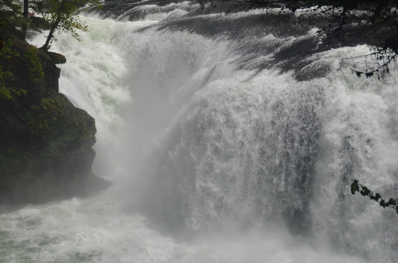
Next we drove up to the lower falls. The first photos are of Swift Reservoir
This photo attempts to give an impression of the elevation.
The snow is melting.
Yep they are also tall tress ieven if they are not red woods.
This is the Lower Falls. If the dams were not activated Salmon would swim up to this falls where they were blocked from going further up the river. Indians would spear them at this location.
I put my toes in the Pacific and my boot sole in this melting snow river.
Friday Chuck and I went to the north side of Mt. St. Helen up to the Johnston Ridge Observatory. This view is of the North side of Mt. St. Helen that blew out in 1980 when it erupted.
This view of the North Face of Mt. St. Helen was from the windows behind the screen that showed the devastation of the eruption in 1980 of the Obwervatory.
The north rim (gone) and the lava bubble.
Tress, now logs, that were blown over by the 300 mph shock wave with cooled lava rock in it.
A face of the next mountain side that was wiped clean by the land slide and shock wave.
Elk in the center of this photo.
This is an enlarged photo of the Elk.
Chuck was behind me, "Chuck, don't throw that at me."
One of the stumps that was effected by the eruption.
The trees in this area have a rough visual effect. I was not able to capture the true effect but their vertical and horizontal branches create a square matrix like a test screen.
This Coldwater lake did not exist before the 1980 eruption. The stream was damned up with logs and ash to create this lake. Clear water.
Mt. St. Helen top peaking through some clouds.
This lower area is of Ash that has settled in this valley. The width should give you a feel what 600 feet of ash can do. Note the small stream during this spring thaw in the middle.
Back to the Ti-Mountain RV Park and we notice Mt. St. Helen in full view with a few clouds around it.
Mt. Hood in Oregon.
Mt Adams to the South East.
I arrived here on Friday and a week later I was able to see them from this location.


No comments:
Post a Comment